|
|
|
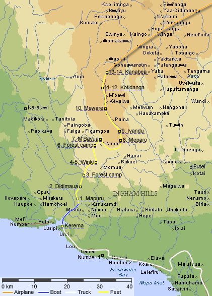
| III. Rainforest trek This map shows our rainforest trek from Kerema to Kanbea. Originally we had planned to go all the way to Menyamaya. As it turned out we got about half the way. Worth noting is that the maps we had bought were printed 1979. Since then, a lot of villages had been relocated, changed names, or both. The confusion was total and at one moment we even decided that something was wrong with the GPS. It wasn't! On the map we have marked each place we slept at during the trek. I.e. the first night we slept in Mapuru, the forth and fifth nights we slept in Winki, and so on. By clicking on the dotted, underlined texts you will be taken directly to a picture relevant for that part of the journey. |
|
|
© 1999-2002 • Graphics Nicklas Nordborg • Text Nicklas Nordborg |